Topographic Survey Map with Infrastructure Symbols CAD File
Description
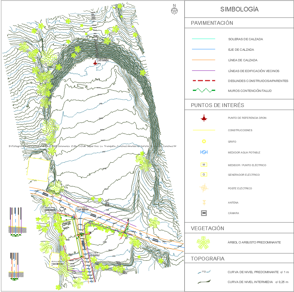
This detailed topographic survey map highlights elevation contours, vegetation, and essential infrastructure elements such as water meters, electric poles, and roadways. It includes a comprehensive legend for interpreting paving, construction boundaries, and topographic levels, making it ideal for civil engineering and land development planning.